

Edinburgh is a city you can see on foot in a single day, from a volcano in the middle of town to a tidal island and a range of hills on the edge of the bypass. This guide picks the 20 walks in Edinburgh that give the most for the effort, from short climbs with big views to riverside paths, old railway lines and coastal routes, with each one checked against the people who manage it.
For every walk you get the distance, a realistic time, how hard it is, where to start and how to get there without a car, plus anything closed or diverted right now. All are free to walk, and nearly all can be reached by Lothian services from the city centre.
Updated 11 November 2026. Distances and times come from the managing bodies (Historic Environment Scotland, the Water of Leith Conservation Trust, Pentland Hills Regional Park, Scottish Canals, Midlothian Council) and from the routes described on Walkhighlands. Path closures change often, so check the links in each entry before you set off.
Edinburgh Walks at a Glance
| Walk | Distance | Time | Terrain | Start |
|---|---|---|---|---|
| Arthur’s Seat and Salisbury Crags | 4.75 km / 3 mi circuit | 2–2.5 hrs | Rocky final climb | Holyrood Palace |
| Calton Hill | 1.75 km / 1 mi | 1–1.5 hrs | Surfaced, with steps | Waverley Steps |
| Hermitage of Braid and Blackford Hill | 4.25 km / 2.75 mi | 1.5 hrs | Glen, then one climb | Braid Road |
| Braid Hills | 4.5 km / 2.75 mi | 1.5 hrs | Tracks, often muddy | Braid Hills Approach |
| Corstorphine Hill | 4.5 km / 2.75 mi | 1–1.5 hrs | Woods and steps | Queensferry Road |
| Water of Leith Walkway | 13 mi (21 km) in full | About 5 hrs in full | Mostly level | Balerno or Slateford |
| Dean Village and Stockbridge | 4.5 km / 2.75 mi | 1–1.5 hrs | Riverside, steps | Stockbridge |
| Colinton Tunnel and the Dells | 5 km / 3 mi | 1.5 hrs | Dells and cycle path | Slateford |
| Union Canal towpath | 31 mi (51 km) in full | Any section | Flat and level | Lochrin Basin |
| Innocent Railway | Linear, 518 m tunnel | Any section | Flat, gentle tunnel | St Leonard’s |
| Royal Botanic Garden and Inverleith Park | Your choice | 1–2 hrs | Level lawns | East or West Gate |
| Royal Mile | About 1 mi one way | Your choice | Cobbles, downhill | Edinburgh Castle |
| Cammo Estate | Your choice | 1 hr or more | Woods and grass | Cammo Walk |
| Cramond Island and the River Almond | 8.75 km / 5.5 mi | 2–3 hrs | Tidal causeway | Cramond |
| Portobello Promenade | About 2 mi one way | Your choice | Flat promenade | Portobello |
| Dalmeny Estate shore | 10.5 km / 6.5 mi, linear | 2.5–3 hrs | Lanes and tracks | Dalmeny Station |
| Glencorse View from Flotterstone | 5.75 km / 3.5 mi | 1.5 hrs | Hill tracks | Flotterstone |
| Capital View, Hillend | 4 km / 2.5 mi | 1.5–2 hrs | Hillside climb | Hillend |
| Torduff Water, Bonaly | 2.5 km / 1.5 mi | About 1 hr | Woods, short climb | Bonaly |
| Roslin Glen | 4.25 km / 2.75 mi | 1.5–2 hrs | Glen, many steps | Rosslyn Chapel |
Times are walking time without long stops. Distances are for the routes linked in each entry; your own version may be longer or shorter.
Hill Walks and Viewpoints in the City
Edinburgh is traditionally said to be built on seven hills, and you can climb any of them before lunch. These five routes give the widest views; the first two are the busiest, the other three feel more like the countryside.
1. Arthur’s Seat and Salisbury Crags

The highest point in the city is an old volcano at 251 m, inside Holyrood Park, and climbing it is a proper hill hike in the middle of town. Several routes lead to the top; the Walkhighlands circuit climbs along the top of Salisbury Crags first, then takes the steep stepped path to the rocky summit, where the panoramic views run from the Castle to the Bass Rock. It comes back over the quieter Whinny Hill and past St Margaret’s Loch.
Historic Environment Scotland keeps the park open 24 hours, year round and free. The northern part of the Radical Road below the crags is still closed because of rockfall, as are the climbing areas, but the southern section near Duddingston, with Hutton’s Section and the South Quarry, is open again. The High Road is closed to cars, which makes it pleasant on foot.
Plan it: 4.75 km (3 mi), 2–2.5 hrs, 279 m of ascent. Begin by the Palace of Holyroodhouse, a short walk from the foot of the Royal Mile. Wear shoes with grip: the final climb is rocky and slippery when wet.
Read more in our Arthur’s Seat guide.
2. Calton Hill

Calton Hill rises only 103 m, but the view down Princes Street to the Castle is one of the finest in the city, and it is the quickest climb on this list, and an easy one. The monuments on top make it a short history walk too: the unfinished National Monument, begun in 1826 and halted when money ran out in 1829, the round Dugald Stewart Monument and the City Observatory.
The Nelson Monument (1807–1815) has a time ball that drops as the One O’Clock Gun fires from the Castle. Culture Edinburgh opens it daily from 10am to 3.30pm, with a small charge to climb.
Plan it: 1.75 km (1 mi), 1–1.5 hrs including Regent Terrace, from the Waverley Steps at the east end of Princes Street. There is a long flight of steps on this one.
Our Calton Hill page covers the monuments in more detail.
3. Hermitage of Braid and Blackford Hill
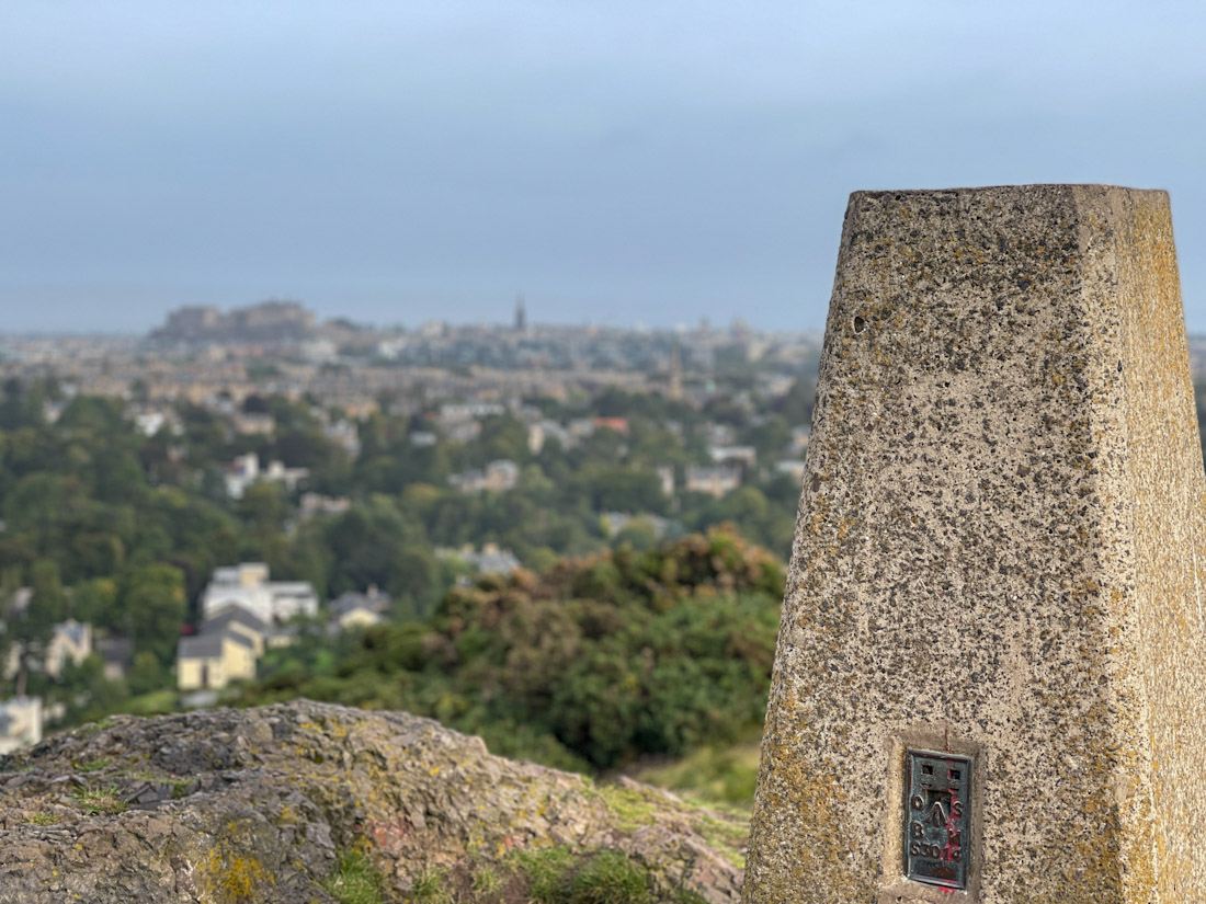
This is one of the best walks in the south of the city: a wooded glen along the Braid Burn, then a climb onto Blackford Hill beside the Royal Observatory for a big view north over the Old Town. Both are part of one local nature reserve run by the council’s Forestry and Natural Heritage team.
The Friends of the Hermitage point out two level, surfaced stretches for wheelchairs and buggies: Braid Road to Hermitage House and the Scout Bridge, and the Observatory car park to the radio mast. It can be muddy after rain.
Plan it: 4.25 km (2.75 mi), 1.5 hrs, 137 m of ascent, from the Hermitage entrance on Braid Road. Lothian 11 or 15 to Comiston Road.
4. Braid Hills

The southernmost of the seven hills is largely golf course, but public tracks loop round it with open views to the Pentlands and the Forth. It is quieter than Blackford, and a good walk to combine with the Hermitage next door.
Horses use the same tracks, and parts become very muddy in winter, so this is one for boots.
Plan it: 4.5 km (2.75 mi), 1.5 hrs, from the golf course on Braid Hills Approach. Lothian 11 or 15 to Comiston Road, then walk up.
5. Corstorphine Hill

The most westerly of the seven hills is a long, wooded ridge with woodland trails, a walled garden and the Rest and Be Thankful viewpoint, with views east over the city. It feels a long way from the city even though Edinburgh Zoo sits on its southern slopes.
The Friends of Corstorphine Hill open the tower on top on Sundays from 2pm to 4pm between May and the end of September (donations welcome), and look after the Walled Garden, open every day. Some sections are steep, with steps, and slippery after rain.
Plan it: 4.5 km (2.75 mi), 1–1.5 hrs, 124 m of ascent. Enter from Queensferry Road (Lothian 47 runs along it) or park on Clermiston Road North.
River, Canal and Railway Paths
These are the flat ones. The city’s river, its canal and two old railway lines give you long routes away from traffic that are easy to join and leave, and most are shared with cyclists.
6. Water of Leith Walkway

The Water of Leith Walkway follows Edinburgh’s river for 13 miles from Balerno to Leith and passes Colinton, the Union Canal, Murrayfield, the Galleries of Modern Art, Dean Village, Stockbridge and the Royal Botanic Garden. It is well signposted, mostly level and partly accessible by wheelchair.
The Water of Leith Conservation Trust gives Balerno to Slateford as 5 miles and Slateford to Leith as 7.5 miles, about five hours of walking in all; Roseburn to Stockbridge takes about 45 minutes. At Slateford, its Visitor Centre at 24 Lanark Road has a free exhibition and a café, open daily from 10am to 4pm.
Closures in November 2026: the Kinauld Tannery footbridge near Currie is closed with a signed diversion via Lanark Road and Kirkgate; the path between Coalie Park and Sandport Place bridge in Leith is closed for about two weeks from 9 November (diversion via Coburg Street); and the link bridge at Powderhall / St Mark’s Park remains shut.
Plan it: Lothian 44 to Balerno for the first section, and many services to Slateford, Stockbridge and Leith for shorter ones. The Trust’s audio trail gives a commentary as you go.
See our things to do in Stockbridge guide for a stop along the way.
7. Dean Village and Stockbridge

A short circular walk from Stockbridge takes in Georgian streets, the two Galleries of Modern Art and then the riverside trail back through Dean Village, the old milling village in the gorge below the Dean Bridge. On the way you pass St Bernard’s Well, open only on Sundays in August and on Doors Open Day, and one of Antony Gormley’s ‘6 Times’ figures standing in the water.
Modern One and Modern Two on Belford Road charge nothing for entry and open daily from 10am to 5pm, with charges for some exhibitions.
Plan it: 4.5 km (2.75 mi), 1–1.5 hrs, with long flights of steps. No parking: take Lothian 24 or 29 to Stockbridge.
8. Colinton Tunnel and the Dells

Starting at the Water of Leith Visitor Centre, this circuit follows the river up through the wooded Craiglockhart and Colinton dells, then returns along the old Balerno branch railway and the Union Canal, crossing the aqueduct high above the river.
The highlight is Colinton Tunnel, a 140 m former railway tunnel painted end to end by a team led by artist Chris Rutterford around Robert Louis Stevenson’s poem ‘From a Railway Carriage’, finished in 2021. It is on the public path, so it is open at all times with no charge.
Plan it: 5 km (3 mi), 1.5 hrs, from Slateford (details). For the tunnel alone, Lothian 10, 16 or 44 to Colinton, then walk down to the river.
9. Union Canal Towpath

The Union Canal runs 31 miles from Lochrin Basin at Fountainbridge to just above the Falkirk Wheel, following one level the whole way, so the towpath is the flattest long walk in Edinburgh. Scottish Canals manages it.
Most people walk just a section: west from the city past the Leamington Lift Bridge and the canal boats, or out to the Slateford Aqueduct, where the canal crosses the Water of Leith and you can drop down to the river for a circular walk. Bikes share the trail, so keep left.
Plan it: Lochrin Basin is a short walk from the West End and Tollcross; you can leave at almost any bridge.
10. Innocent Railway
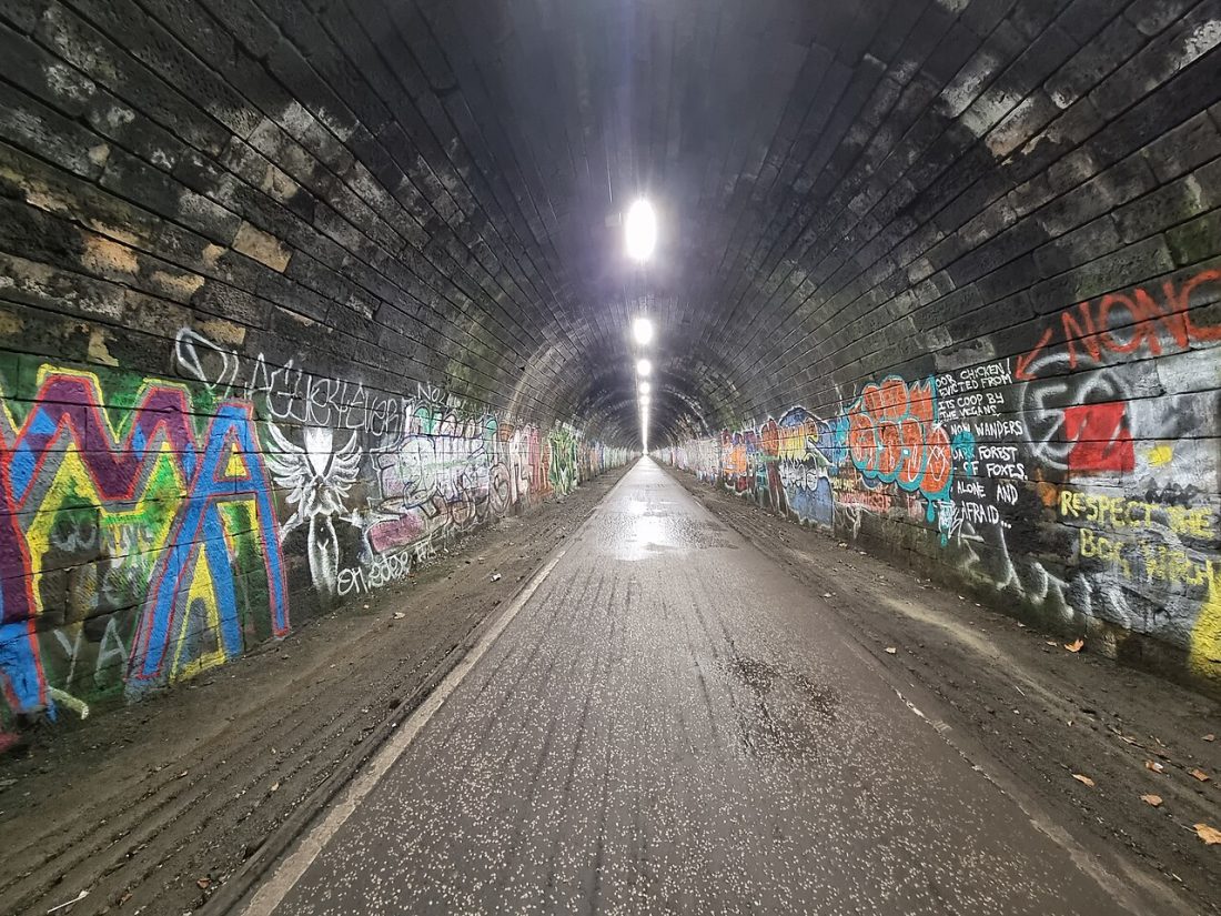
Edinburgh’s first railway, opened in July 1831, carried coal in horse-drawn wagons, which is why it was called the ‘Innocent Railway’. Historic Environment Scotland notes that the story of nobody being hurt on it is not true. Its 518 m tunnel, the first railway tunnel in Scotland, still runs from St Leonard’s under the edge of Holyrood Park.
Since the 1980s the line from St Leonard’s to Brunstane has been a flat walking and cycling trail (National Cycle Network Route 1) via Duddingston and Craigmillar. The tunnel climbs at about 1 in 30 towards St Leonard’s, which you will notice on a bike.
Plan it: The western end is off St Leonard’s Street in Newington; walk as far as you like and return the same way.
Gardens, Parks and the Old Town
Not every walk needs a hill. These three are easy, level and close to the centre, and good choices with children or on a wet day.
11. Royal Botanic Garden and Inverleith Park
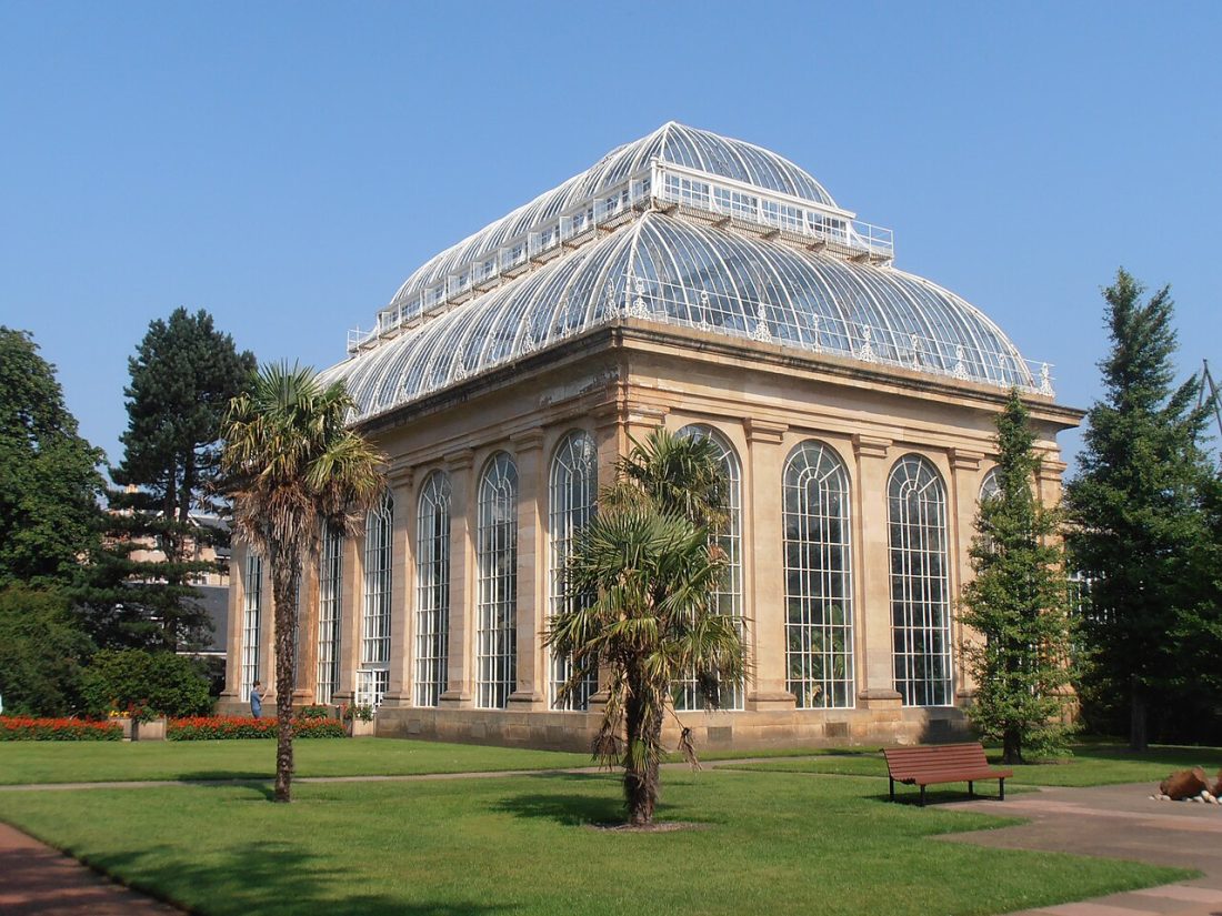
The Royal Botanic Garden Edinburgh, one mile north of the centre, covers more than 70 acres and is free to enter. It opens daily from 10am, until 4pm in November and January and 3.30pm in December, and closes on 25 December and 1 January. The restored Palm Houses reopened on 2 October 2026 with timed tickets; the other glasshouses are still closed for restoration.
Next door, Inverleith Park adds a big open circuit with a pond and a quiet sundial garden.
Plan it: East Gate on Inverleith Row (Lothian 8, 9, 23 or 27) or West Gate on Arboretum Place (24, 29). Christmas at the Botanics, a ticketed evening event, runs from 19 November to 30 December 2026.
More green spaces are in our parks in Edinburgh guide.
12. The Royal Mile
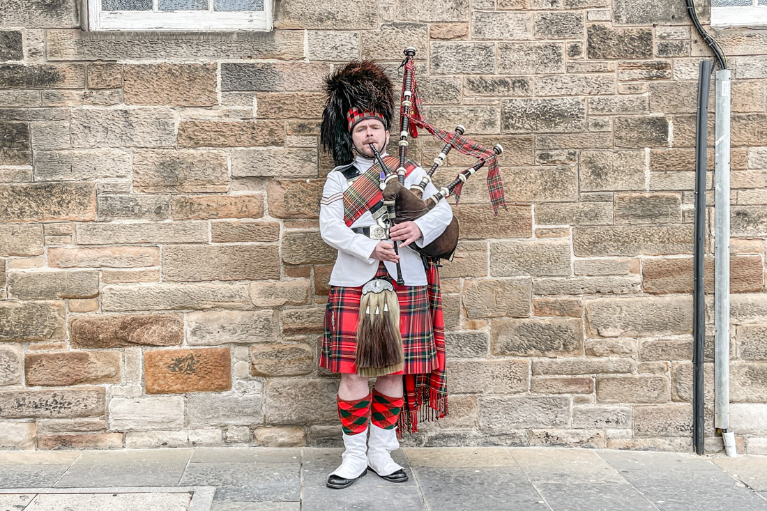
The Royal Mile is about a mile long and runs downhill from Edinburgh Castle to the Palace of Holyroodhouse, through the heart of the Old Town. The street itself is busy, so the nicer walking is in the closes and courtyards off it, which open onto views over the New Town.
Combine it with Arthur’s Seat: walk down the Mile, then straight into Holyrood Park at the bottom.
Plan it: Begin at the Castle Esplanade and finish at the foot of the Canongate.
For a guided version, see our Edinburgh walking tours.
13. Cammo Estate
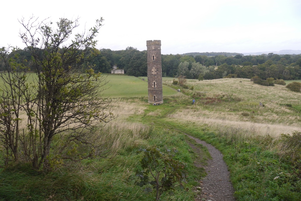
Cammo, on the north-west edge of the city, is a council local nature reserve of about 100 acres of woodland, glades and grassland, with woodland walks, a walled garden, a pinetum, the ruins of Cammo House and an old water tower in the fields.
Edinburgh Outdoors lists a small visitor centre open on Sundays from 2pm to 4pm and a coffee van daily, weather permitting.
Plan it: Lothian 47 to Cammo, or drive to Cammo Walk or the north and main gates. A good one for families and dogs.
Coastal Walks on the Firth of Forth
Edinburgh has a long shoreline on the Forth coast, with a sandy beach at Portobello, and its coastal routes are flat and full of sea air. One is tidal, so read that entry closely.
14. Cramond Island and the River Almond

At low tide a concrete causeway from the beach at Cramond, lined by Second World War anti-boat pylons, leads out to Cramond Island. The Walkhighlands route crosses to the island, climbs to its viewpoint over the islands and bridges of the Forth, then comes back up the River Almond past the old mills to Cramond Brig.
Safety: the causeway can be crossed for up to about two hours either side of low tide, and the lifeboat crew are called out to stranded walkers regularly. Check the safe crossing times on the board by the causeway, by texting CRAMOND to 81400, or on the RNLI Queensferry page, and head back in good time.
If the timing is wrong, walk the promenade and beach east towards Silverknowes instead; it is flat and away from traffic.
Plan it: 8.75 km (5.5 mi), 2–3 hrs. Lothian 47 to Cramond; spaces in the village fill up at weekends.
See our beaches in Edinburgh guide for Cramond and Silverknowes.
15. Portobello Promenade

Portobello’s promenade runs for about 3 km behind the sandy beach from Portobello to Joppa, flat and lively all year, with cafés along the way. Walk one way and catch a bus back, or turn at Joppa Rocks.
Edinburgh Leisure says the Turkish Baths in the 1898 Portobello Swim Centre on the prom are currently closed for maintenance; the main pool is open.
Plan it: Lothian 12, 15 or 26 to Portobello.
16. Dalmeny Estate Shore Walk

This linear walk follows part of the John Muir Way, the 134-mile coast-to-coast route, from South Queensferry through the wooded Dalmeny Estate, close to the shore, past Dalmeny House and Barnbougle Castle to Cramond Brig. The Forth Bridge, the Forth Road Bridge and the Queensferry Crossing are behind you as you set off.
You can also walk over the Forth Road Bridge to North Queensferry: it is open to pedestrians and cyclists but closes to them when winds reach 50 mph (check before you go). The Queensferry Crossing is a motorway with no access on foot.
Plan it: 10.5 km (6.5 mi), 2.5–3 hrs. Train to Dalmeny Station (or Lothian 43 to South Queensferry), and a bus back from Cramond Brig. The ferry that once crossed the River Almond at Cramond closed in 2000.
Plan the rest of the day with our things to do in South Queensferry guide.
Walks Near Edinburgh: Pentland Hills and Roslin Glen
For a real hike, the Pentland Hills Regional Park starts just beyond the city bypass, with about 100 km of marked paths and the best hill walking near the city. Roslin Glen is a wooded gorge a short ride south.
17. Glencorse View from Flotterstone
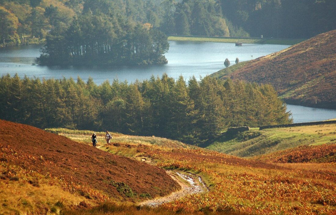
The most popular entrance to the Pentlands is Flotterstone, with an information point and café. The waymarked Glencorse View trail, a good first hike in the hills, climbs above Glencorse Reservoir, which has supplied some of the city’s water since the 1820s, with an optional detour to the Iron Age fort and souterrain on Castle Law.
Warning notices line the track: the slopes of Castle Law are an MOD firing range, so stay on the signed route. Keep dogs on a short lead near sheep, as the Scottish Outdoor Access Code asks.
For something gentler, the Harlaw woodland walk near Balerno (Lothian 44) is a 3.5 km easy trail round Harlaw Reservoir, with a biodiversity trail for children.
Plan it: 5.75 km (3.5 mi), 1.5 hrs. Houstons 101 or 102 to the Flotterstone Inn; parking at Flotterstone (EH26 0PP) fills quickly.
18. Capital View, Hillend

This waymarked route climbs above the snowsports centre at Hillend across the northern slopes of the hills, giving wide views over the city and the Forth: a shorter hike than the full climb to the ridge.
The Regional Park grades it moderate. It is steep in places, so allow extra time for the walk up from the road.
Plan it: 4 km (2.5 mi), 1.5–2 hrs, 203 m of ascent, from the lower car park below the snowsports centre. Lothian 4 or 15, or Houstons 101 or 102.
19. Torduff Water, Bonaly
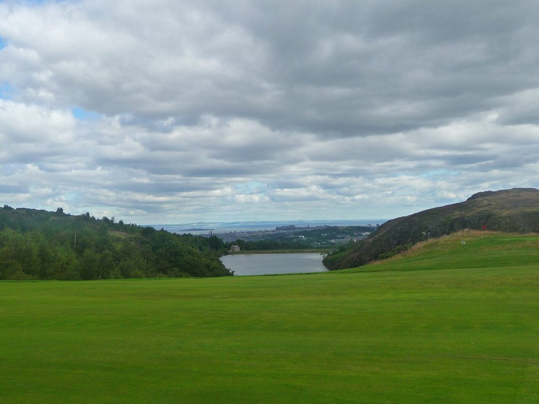
From Bonaly Country Park at the edge of Colinton, a short waymarked loop climbs through woodland to Torduff Reservoir, a Victorian reservoir in a quiet valley. It is a good first taste of the Pentlands, and longer routes into the hills start from the same car park.
The Regional Park lists Torduff Water as 1.5 mi (2.5 km) and moderate, and the hill routes beyond are rough and exposed in bad weather.
Plan it: Lothian 10 to Bonaly, then walk up Bonaly Road over the bypass. Parking: EH13 0PB.
20. Roslin Glen
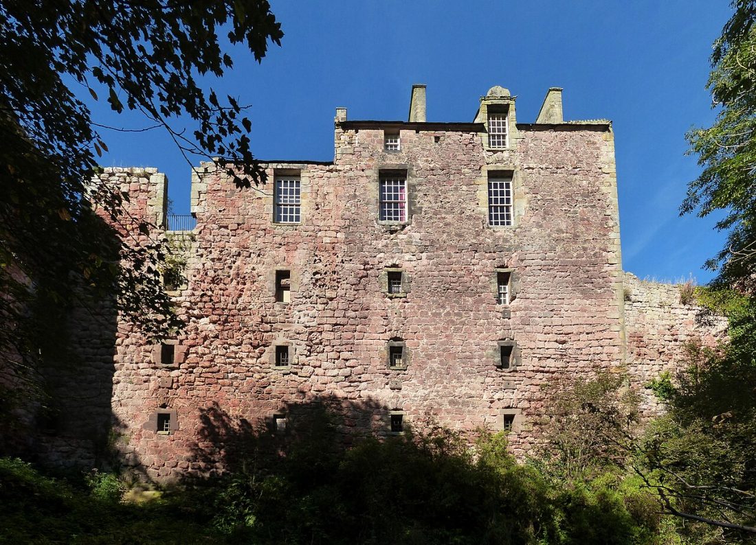
A loop from Rosslyn Chapel drops into Roslin Glen Country Park, a wooded gorge of the River North Esk run by Midlothian Council, past the remains of a gunpowder mill (1804–1954) and up to Rosslyn Castle on its cliff. The castle is private.
There are a lot of steps. Visit the chapel before or after; it charges for entry.
Plan it: 4.25 km (2.75 mi), 1.5–2 hrs. Lothian 37 to Roslin, or use the parking at the country park.
Our day trips from Edinburgh by bus guide has more on Roslin.
Tips for Walking in Edinburgh
- Footwear and weather: before any hike, remember that hill paths and the Pentlands get muddy and slippery, so wear boots or shoes with grip and carry a waterproof layer year round.
- Tides: never set off for Cramond Island without checking the day’s safe crossing times.
- Closures: check the Water of Leith Conservation Trust and Holyrood Park pages for diversions before you go.
- Dogs: keep them under control and follow signs about leads during the bird nesting season in Holyrood Park and near livestock in the Pentlands.
- Access: the Scottish Outdoor Access Code applies everywhere: take litter home and leave gates as you find them.
- Getting about: almost every walk here begins on a Lothian route; the Pentland Hills Regional Park has no train station and no buses on the A70 side.
Walks in Edinburgh: FAQ
What is the best walk in Edinburgh for beginners?
Calton Hill is the easiest walk in Edinburgh with a big view: about 1.75 km from the east end of Princes Street. The Royal Botanic Garden, the Dean Village loop and Portobello Promenade are also level and easy.
How long does it take to walk up Arthur’s Seat?
Allow 2–2.5 hrs for the 4.75 km circuit from Holyrood Palace via Salisbury Crags. The last part is steep and rocky.
Is Cramond Island safe to walk to?
Yes, if you cross only in the posted safe crossing window around low tide and leave the island in good time. Check the board at the causeway or text CRAMOND to 81400.
Is the Water of Leith Walkway open?
Yes, but in November 2026 there are diversions near Currie (Kinauld Tannery footbridge) and in Leith between Coalie Park and Sandport Place, and the Powderhall link bridge is closed.
Which walks near Edinburgh can I reach by bus?
The Pentlands (Houstons 101 or 102 to Flotterstone, Lothian 4 or 15 to Hillend, 10 to Bonaly), Roslin Glen (Lothian 37), Cramond (47) and South Queensferry (43) are all reachable without a car.
Are these walks free?
Yes. All 20 are free; you only pay for extras such as the Nelson Monument climb, the Palm Houses or Rosslyn Chapel.